Our New Map Viewer
Our map viewer control has gotten old, so we leveraged Leaflet, an open source javascript map viewer control to bring our mapping feature into the 2020's.
Our map viewer control has gotten old, so we leveraged Leaflet, an open source javascript map viewer control to bring our mapping feature into the 2020's.

The Make Forms feature in Landboss is a powerful feature that allows you to quickly generate lease documents like offer letters, lease agreements, and more, with just a few clicks.

The Landboss website was overdue for a facelift, so after several weeks of work, we're happy to usher in the new year with the fresh new design that you are enjoying now.

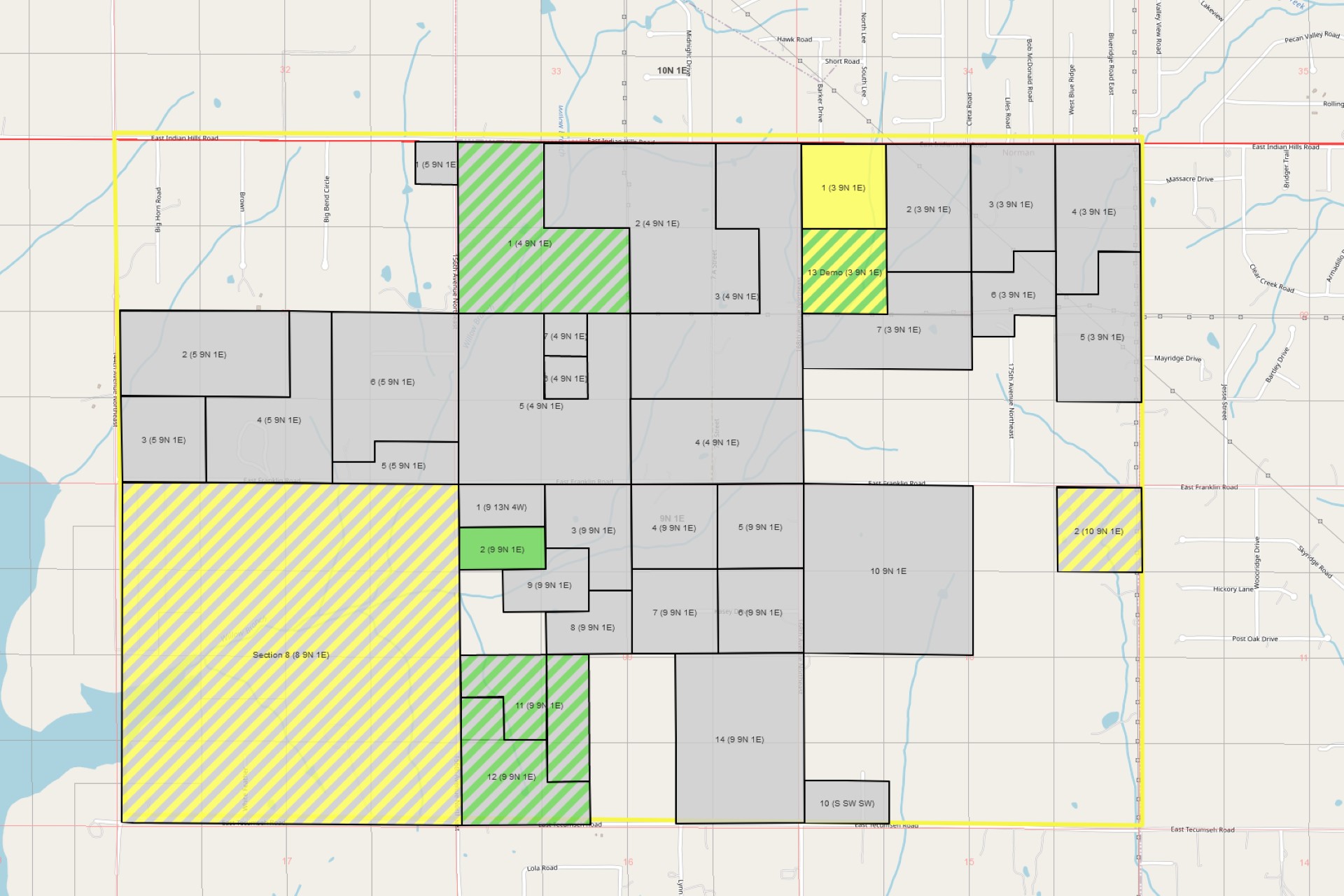
Customers can now print the maps from Landboss and tracts will be colored by lease status. In addition, we added a zoom to feature which makes it a snap to zoom to a specific STR.
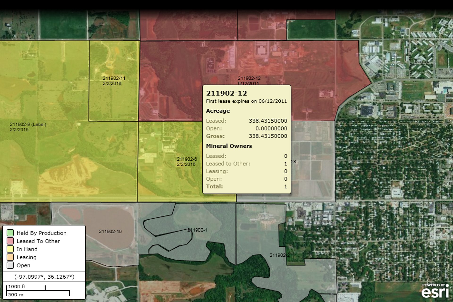
A couple of weeks ago, after careful consideration, we made the decision to switch mapping servers from Autodesk's Mapguide to Esri's ArcView. Mapguide is a fine product and the feature to cost ratio is great, but we have outgrown it's capabilities and are in need of something more robust.

A lot of time has gone by since my last blog entry and it seems like it was travelling by plane. We’ve been hard at work improving our flagship product Landboss as well as getting our upcoming mineral management application, Mineralboss, ready for release, which is what I’d like to tell you a little bit about in this post.

Several weeks back we finished integrating Simplifile's e-Recording service with Landboss. This new service addition allows users of Landboss to file their leases using Simplifile's electronic service.

The past month has seen a huge increase in activity here at LANDBOSS, including demos, free trials, and paying customers. The list of user-requested features has gotten quite long, however, so we've decided to begin pushing out weekly updates instead of larger, monthly releases.

One of the concerns we've heard with LANDBOSS is that it can sometimes be a challenge to tell how certain features work without at least a decent amount of data in the system. Of course we have a spiffy data import tool that can quickly get your real data into LANDBOSS, but before that task is completed a new account can feel barren, maybe even a little lonely.
For those that are unfamiliar, NAPE is a large oil & gas industry expo in Houston. This year's will be held Feb 11-12, and we're currently working full-tilt to get some very cool features implemented by then.